

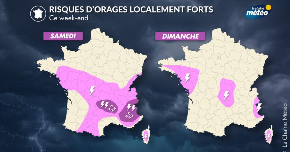
Isolated storms throughout the country, but sometimes severe.
After several days of intense heat, significant amounts of energy will build up in the atmosphere, which will support the development of localized severe thunderstorms over the weekend. No matter what, these storms will not be able to cool the atmosphere forever. They will not mark the end of the heat wave as the air mass remains exceptionally warm at altitude under the influence of the heat dome.
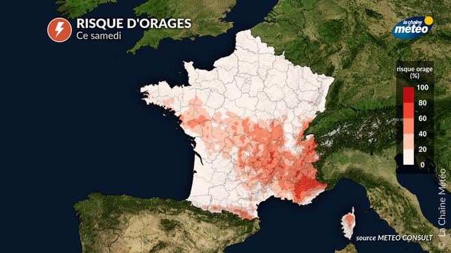
Thunderstorms are expected on Saturday. © La Chaine Meteo / Meteo Consult
Saturday, the riskiest day in the country
On Saturday, the risk will be greatest in the southeast, especially in the Alps and inland areas of the Mediterranean (Gorges du Verdon, Luberon), as well as in the Massif Central and Rhone Valley. The most severe storms can produce heavy rain in a short time, causing flooding or landslides, hail, intense electrical activity and wind gusts that can exceed 80-100 km/h.
On Sunday, the risk of thunderstorms decreases significantly and remains limited to the topography of the Alps and Corsican Mountains. However, a few isolated storms may develop in the center and north-west of the country without much strength.
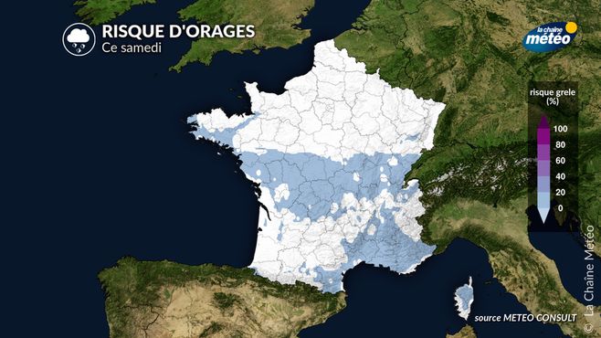
Possible hail this Saturday © La Chaine Meteo / Meteo Consult
Risk of fires associated with these hurricanes
The current alarming situation of severe drought is affecting most of the country. Lightning strikes, sometimes very numerous during a thunderstorm, can start wildfires, especially in areas where vegetation has dried out greatly.
Towards a more organized and widespread deterioration of the situation next week?
The heat wave will reach its peak between Sunday and Tuesday, with intense heat of more than 40C across much of the western half, as well as the center of the country. The exit from the heat wave is expected to occur between Thursday and next Friday, with possible air mass conflict between cooler ocean air and very hot air present over the country for several days. This could lead to a more organized and potentially stronger storm deterioration that will likely mark the end of the third heat wave. However, reliability is still limited in the medium term, especially regarding the intensity and location of these storms.