

Nor’easter Hammers East Coast as Full Moon Worsens Flooding – December 16, 2026 Update
A powerful early‑season nor’easter is slamming the East Coast this weekend, bringing a dangerous mix of coastal flooding, high surf, strong winds, heavy rain and rip currents from North Carolina to New England. The storm’s impact is amplified by a full moon that is pushing tides to higher than normal levels, creating a particularly risky situation for communities along the shoreline.
Happening Now
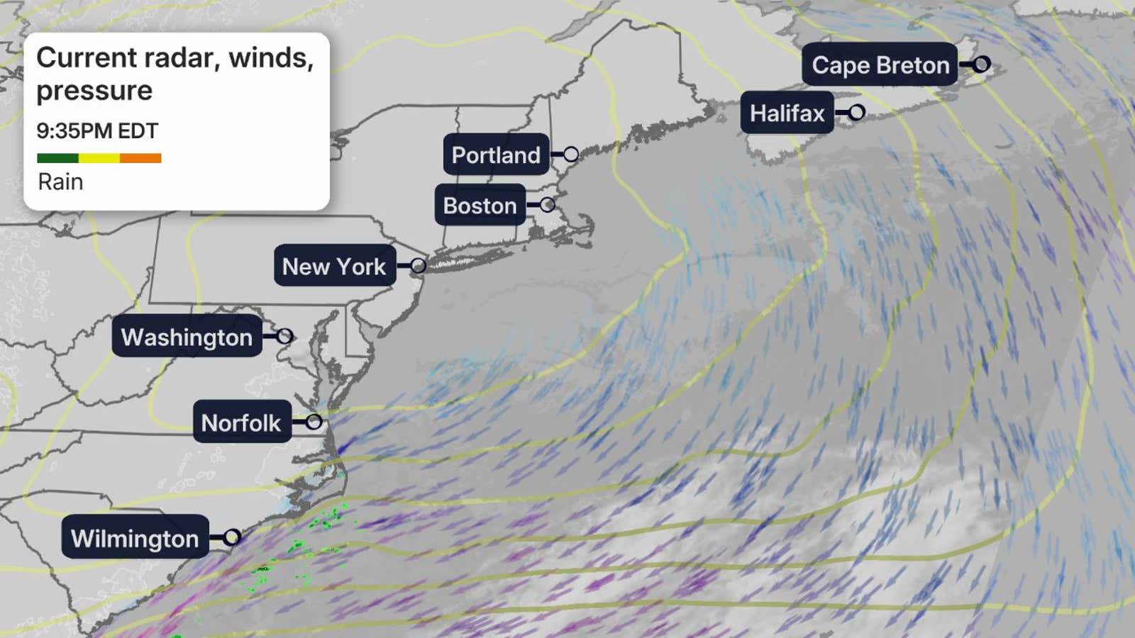
The storm’s peak intensity is currently lashing the mid‑Atlantic and New England as high tide unfolds. Coastal flooding is reaching its worst Saturday, with the National Weather Service warning of major inundation from the Jersey shore up through the northern Outer Banks of North Carolina. Wind gusts over 50 mph are affecting everything from southern Cape Cod to parts of Long Island, coastal New Jersey, the Delaware coast and the Delmarva Peninsula. Trees are being knocked down and power outages now affect tens of thousands of customers across Connecticut, New York, New Jersey, Massachusetts, Rhode Island, Maryland and the Delmarva Peninsula.
Live updates indicate that emergency crews are responding to flash flooding in low‑lying areas, while road closures—such as a 16‑mile stretch of North Carolina Highway 12 on the Outer Banks—remain in effect due to ocean overwash.
Forecast Timing
- Saturday – Rain and strong winds will persist from Virginia through Maine, including New York City, Philadelphia and Boston. The heaviest rainfall is expected from southern New Jersey into northern Massachusetts, and coastal flooding will peak during the evening high tide.
- Sunday – The nor’easter lingers with lingering rain across much of the Northeast, especially southern New England. Strong winds may continue into early morning from southern New England to the Jersey shore. Some coastal flooding may persist during Sunday’s high tides.
- Monday – The weakened system will bring only scattered rain showers and gusty winds over New England, Long Island and the Hudson Valley. Rainfall intensity should diminish, though Boston may still see heavier showers.
Potential Impacts
Coastal Flooding
The National Weather Service has issued coastal flood warnings covering Atlantic City, Long Island, the Norfolk metro area, Ocean City (MD & NJ), downtown Boston, Cape Cod, Martha’s Vineyard and Nantucket. The most severe flooding is expected from the northern Outer Banks of North Carolina through the Jersey shore, including the Virginia Tidewater, Chesapeake Bay and Delaware Bay. Water levels may rise 2–4 feet above normal at high tide, especially Saturday when the full moon pushes astronomical tides higher. Minor to moderate flooding is also possible on Sunday.
Rain Impacts
Rather than a short, intense deluge, the storm’s rainfall is being spread over several days, which helps reduce the risk of catastrophic flash flooding. However, heavy rain from southern New England to New Jersey could still cause localized urban flooding, especially where drainage is already stressed. The rain also adds to coastal flooding during high tide through Sunday.
Wind Warnings
High‑wind warnings are in effect for southeast New England (Boston, Providence) and the coastal zones of Delaware and New Jersey. Gusts up to 60 mph are possible through early Sunday morning, threatening trees and power lines. Softer gusts of 40–50 mph are expected farther north and south along the coast, with scattered outages and limb damage possible.
Travel Impacts
Travelers heading to the Northeast this weekend should expect significant disruptions:
- Major hub airports—Boston‑Logan and the three New York City airports—are likely to see delays through the weekend.
- Roadways in coastal New England, the NYC metro area and New Jersey may experience downed trees, flash flooding and localized hazards. Avoid coastal zones from northern North Carolina to southeast New England during high tide periods.
For the latest flight and road status, check with airline and transportation authorities before departing.
Recap
As of Thursday evening, widespread gusts of 30–45 mph were already affecting the region, with peak gusts over 45 mph reported along the North Carolina coast. The persistent wind was piling water onto beaches and low‑lying areas, pushing water levels to major flood stage during Thursday’s high tide.
In response, authorities closed a 16‑mile stretch of North Carolina Highway 12 on the Outer Banks and canceled the Oceans Calling festival in Maryland. Power outages now affect tens of thousands of customers across the mid‑Atlantic and New England, with tree damage a leading cause.
What Is a nor’easter?
A nor’easter is defined by winds that blow from the northeast toward the U.S. Northeast. The storms usually form when a low‑pressure system develops off the Atlantic coast, pulling cold continental air southward and warm, moist air northward. While many associate nor’easters with heavy snow, this system is occurring unusually early in the season, so it is delivering rain rather than snow.
Because the low tracks along the warm Gulf Stream, it can tap abundant moisture, creating intense precipitation when it collides with colder air over the interior. Understanding the basics helps residents know why coastal flooding, strong winds and prolonged rain are typical features of these events.
Stay informed – Conditions can change rapidly during a nor’easter. The National Weather Service, local emergency management agencies and your local news outlets provide the most up‑to‑date warnings and watches. Keep an eye on weather apps and official alerts for any new developments.
News, Travel, Science, Government, Society, Climate, Severe Weather, Coastal flooding, Nor’easter, Northeast

