

A heat advisory has been extended for all of southeast Michigan until 8 p.m. Wednesday. Heat index values up to 105° are possible.
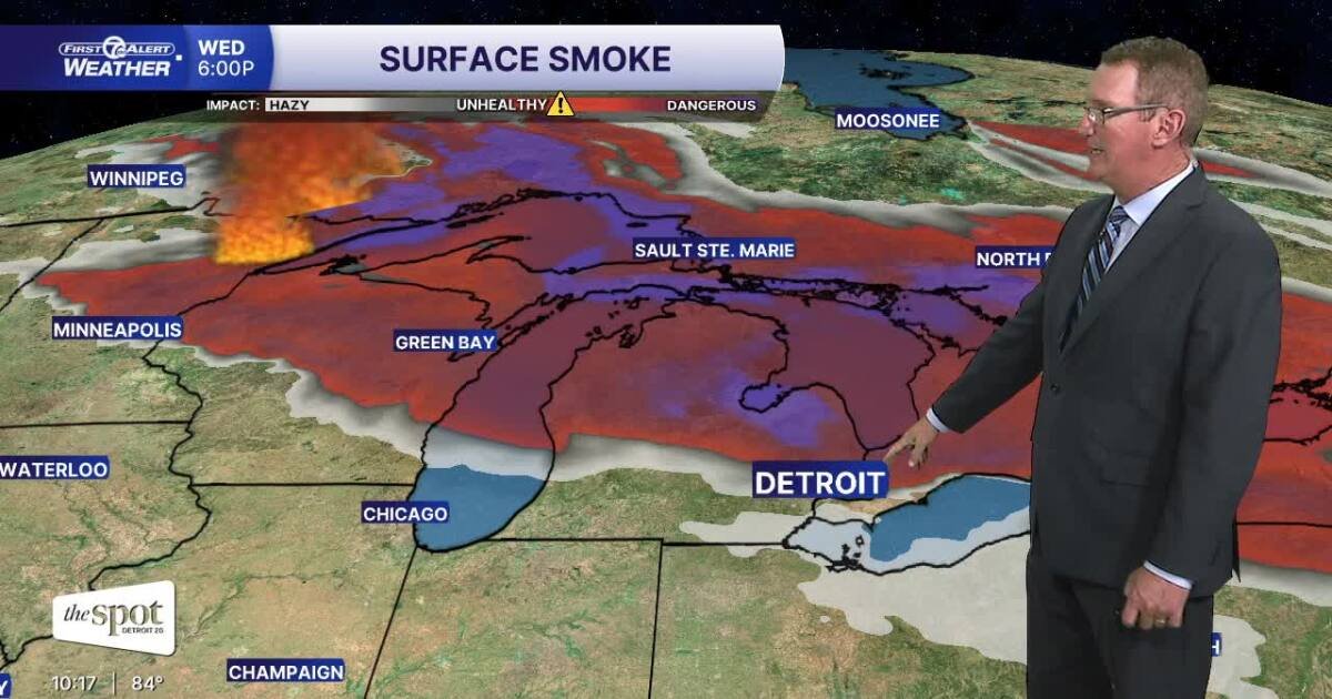
An air quality warning was issued for all of Michigan on Wednesday due to smoke plumes from Canadian wildfires that are expected to move into Michigan. Those with breathing problems can stay home. If enough of this smoke reaches the surface, it can cause poor visibility and poor air quality, especially for people with asthma, COPD or other respiratory conditions.
The heat advisory has been extended until Wednesday. It will feel similar tomorrow when the heat index exceeds 100°. There may be an isolated shower or thunderstorm later in the day. The smoke will spread from north to south and is expected to be strongest late in the day through Wednesday evening. If you are having trouble breathing, you may need to stay home.
See forecast below
More heat and more smoke. Wed.
A few isolated showers or storms will be possible by Friday, with the chance of scattered thunderstorms increasing Saturday as a cold front approaches. This front brings more comfortable conditions for the second half of the weekend, with highs dropping back into the 80s by Sunday.
Tonight: Mostly clear, with a low around 73°. Wind: W 5 mph.
Wednesday: Mostly sunny, hot and humid, with highs in the mid 90s. Smoke from wildfires in northern Minnesota and central Canada will increase from north to south, especially in the afternoon. There may be some light rain or thunderstorms later in the day. Wind: WNW 5-10 mph.
Thursday: Mostly sunny with highs in the mid 90s. Wind: N. 5 mph.
Connect with 7 First Alert meteorologists on Facebook and X:
Facebook: Dave Rexroth , Hallie Vogel, Marisa Voloshin, Mike Taylor
X: Dave Rexroth , Hallie Vogel, Marisa Voloshin, Mike Taylor
- Humidity: 72%
- Dew point: 68°
- Pressure: 30.02 inches
- Wind speed: 6 mph
- Wind direction: W
- Visibility: 10.0 miles
- Sunrise: 06:09
- Sunset: 21:08