

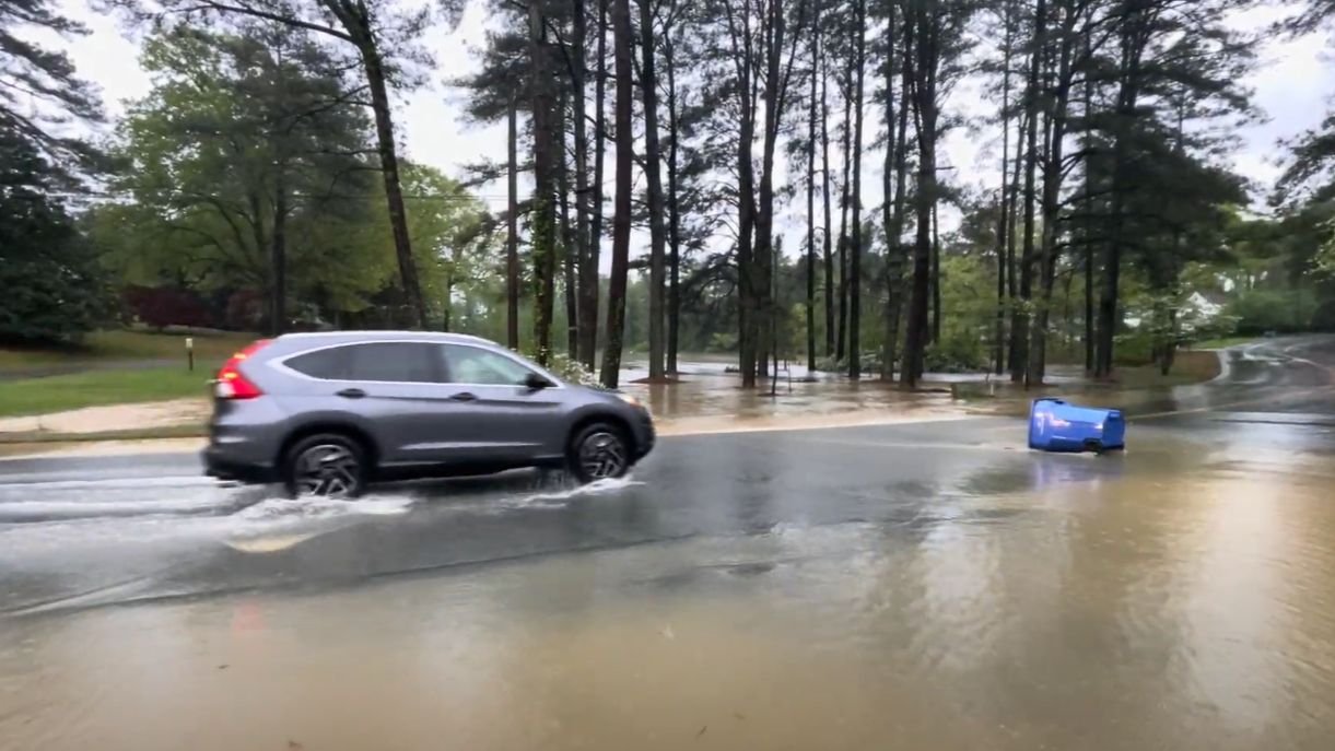
Heavy downpours brought more than 6 inches of rain to High Point from Wednesday evening into Thursday morning, and more rain continues to fall as a slow-moving cold front drenches the state.
What you need to know
- A flood watch is in effect for most of the state.
- Heavy showers and thunderstorms will continue until the end of the week.
- Severe storms that can produce damaging winds remain a possibility.
Thursday’s morning commute was muddy with heavy rain and flash flooding leaving drivers stranded on the road for much longer than expected. Numerous accidents were reported, as well as some flooding on roads.
The right lane of southbound US-1 at Exit 95 in Wake County is closed due to an accident.
For more information click on this link, pic.twitter.com/BfgJApCfz6
— NCDOT Triangle Area (@NCDOT_Triangle) July 23, 2026
Showers and thunderstorms continue to pose travel hazards across the state, with storms expected to continue through the weekend.
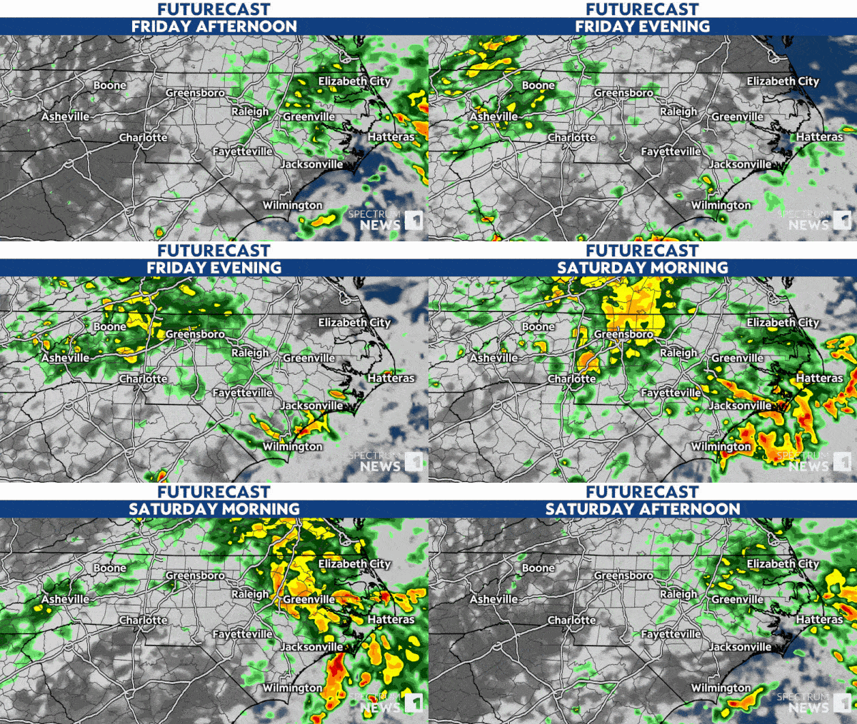
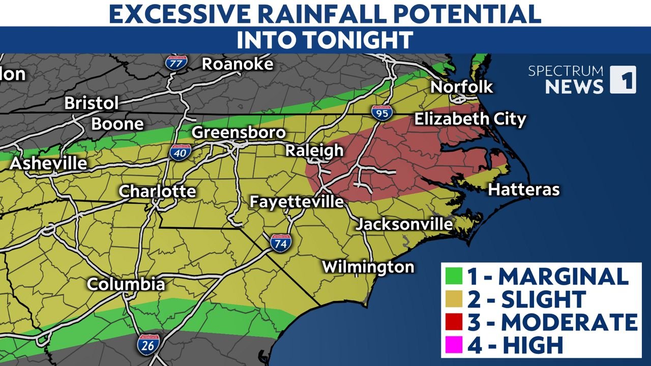
Be prepared for flash flooding as we move into Friday. Then the eastern Piedmont and Coastal Plain will likely experience flash flooding.
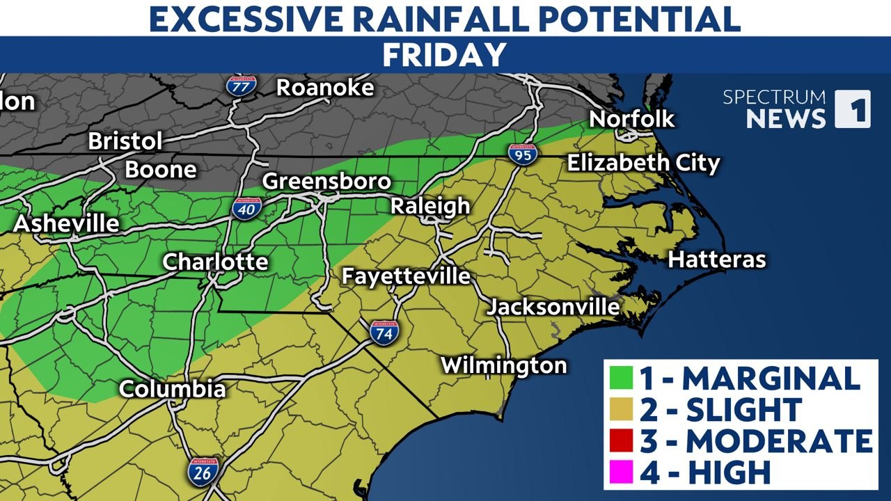
Additional showers and thunderstorms will move in Friday, bringing heavy rain and making the morning commute another muddy one. Remember to avoid these flooded roads at all costs, take an alternate route to your destination and do not attempt to walk through flood water.
Just 6 inches of moving water can knock a person off their feet. Do No try to drive onto a flooded road or go around a barricade; “Turn around, don’t drown!”
Water may be deeper than it appears and may hide hazards such as sharp objects, washed out road surfaces and other hazards.
Sign up for weather alerts to receive the latest weather news and follow this article for the latest details on this event.
Our team of meteorologists takes a deep dive into weather science and collects weather data and information in a timely manner. For more weather and climate stories, visit our weather blogs section.